
Second in a two-part series on how the Navy and its partners are working to improve Arctic operations as the sea ice melts due to warming temperatures.
The future of the Arctic and its stability depend on how effectively the U.S. can depict battlespace awareness in the region. Well-equipped sensors and novel computing methods and artificial intelligence will allow the United States and its allies to reach that goal.
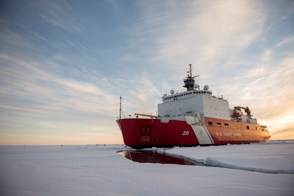
The U.S. National Ice Center (USNIC) and partners are able to sense atmospheric and sea state conditions in the Arctic by using a network of buoys through the U.S. Interagency Arctic Buoy Program (USIABP), but the unforgiving surroundings of the Arctic quickly degrade any deployed hardware.
The resulting data gaps require routine sensor replacements and drive the demand for development of tailored equipment for this cold, icy region. The USNIC most heavily relies on satellite imagery to fulfill its mission. As the sea ice extent continues to be influenced by climate change, the workload for operational centers like the USNIC rises with increased vessel traffic near ice-infested waters.
The USNIC is pursuing automated solutions to combat the uptick in vessel traffic needing ice forecasting products and expertise. This will improve sea ice characterization from its current standards which are reliant on manual analytical methods by trained ice analysts. By incorporating artificial intelligence and machine learning (AI/ML), the USNIC is able to provide enhanced qualitative and quantitative sea ice forecasting and support the safety of navigation.
In situ sensors on buoys deliver invaluable information on the scene for reporting near-real time atmospheric and sea state conditions. They help validate satellite-derived environmental data and identify long-term trends in the region. Buoys are routinely deployed by members of the USIABP, including USNIC personnel, from either ships or aircraft.
International buoy cooperation is essential
In collaboration with 12 nations, the USIABP observations contribute to the broader International Arctic Buoy Programme (IABP) buoy network. Buoys can be costly and require careful planning but the data they collect is necessary to achieve a prosperous and peaceful Arctic region. Since deploying buoys, the USNIC and other IABP partners have gained the ability to validate environmental predictions and identify vital trends in the Arctic for large-scale operations such as Ice Exercise (ICEX) held every two years on the Beaufort Sea.
Deployed buoys are subject to the harsh environment of the Arctic and may become dormant for weeks or months in bad weather, if not destroyed completely by the force of shifting ice. Buoys typically only survive a few years at best before requiring complete replacement. Data gaps also form from the sensors drifting south of the Arctic Circle, no longer reporting conditions proving useful for Arctic operations.
Having additional sensing platforms in the Arctic region and enhancing their performance and design is beneficial not only to global researchers and the USNIC specifically, but it also fulfills a pillar of the U.S. National Strategy for the Arctic Region, which calls for investing “in modernized domain awareness to detect and track potential airborne and maritime threats and improve sensing and observational capabilities, including for sea ice, ship traffic, and weather.”
Artificial intelligence is lending a hand in the Arctic
The USNIC primarily examines Synthetic Aperture Radar (SAR) satellite imagery due to its ability to penetrate clouds and provide reliable, high-resolution coverage throughout day and night.
This imagery in conjunction with AI/ML algorithms is a powerful tool that will allow USNIC and partner services like the Coast Guard’s International Ice Patrol, the Canadian Ice Service, and Danish Meteorological Institute to form better environmental products and predictions of the polar regions.
The embedded potential in using AI/ML processes will further increase the efficiency of the USNIC to effectively support mariners, save ice analysts time and effort as support requests increase and lead to increased comprehension of a changing polar environment.
Even the most advanced AI/ML models at first require substantial data sets to be trained on before becoming a part of the operational workflow to characterize sea ice. Environmental machine learning models that intake satellite imagery can vary in output. While AI/ML applications ideally make manual processes more streamlined and of higher quality, there is significant effort initially to ensure the model is producing accurate and meaningful results for the mission, like classifying multiple stages of sea ice from a single SAR image.
It is a team effort to ensure the Navy can safely operate in the Arctic. Industry partners provide cutting edge oceanographic sensors that aid decision-makers in mission planning. In one key example of working with industry, the USNIC has recently taken part in the Cooperative Research and Development Agreement between Naval Meteorology and Oceanography Command and Sofar Ocean Technologies. This partnership allows further testing of buoy-based sensors in high-latitude operating environments for longevity in severe weather conditions faced in the Arctic.
As the Navy wrote in its strategic blueprint for the Arctic, 90 percent of global trade travels across the world’s oceans, which is expected to double over the next two decades. The Arctic Ocean has the potential to connect over 75percent of the world’s population as melting sea ice opens up timelier maritime trade routes between North America, Europe and Asia.
An opening of the Arctic Ocean brings the U.S. closer to northern neighbors to provide mutual assistance in times of need. It enables allied nations to defend their homeland, deter aggression, and coercion, and protect sea lines of communication.
The Navy’s resilience in the Arctic in the past and its ability to operate there under the changing conditions going forward is embodied by Rear Adm. Robert Peary, credited as the first to land at the North Pole in 1909. “I will find a way or make one,” he said, echoing the ancient Roman-era saying.
Building a more capable Arctic naval force is critical to securing our national security.