The legendary English naturalist Charles Darwin suggested that species most adaptable to changes in the environment – not necessarily the strongest or smartest – are those best suited to prevail.
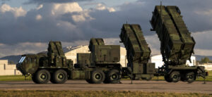
That axiom guides the strategy of the U.S. military, which places a premium on building resilience to overcome the most taxing situations and unpredictability of combat. Now, the Department of Defense is leading the way in adapting its forces to the challenge of climate change to ensure they can still operate effectively in the face of growing environmental stressors such as rising sea levels and more frequent and intense weather events.
But to spend resources wisely, the time has come for a more sophisticated approach to assessing the risk of climate change; an approach that relies on cutting-edge modeling tools to assess how and where adverse consequences are most likely to occur in the future. Without such a comprehensive approach, the Pentagon is at serious risk of wasting billions of dollars on mitigation efforts that do little to prepare for the future.
U.S. military installations already at risk
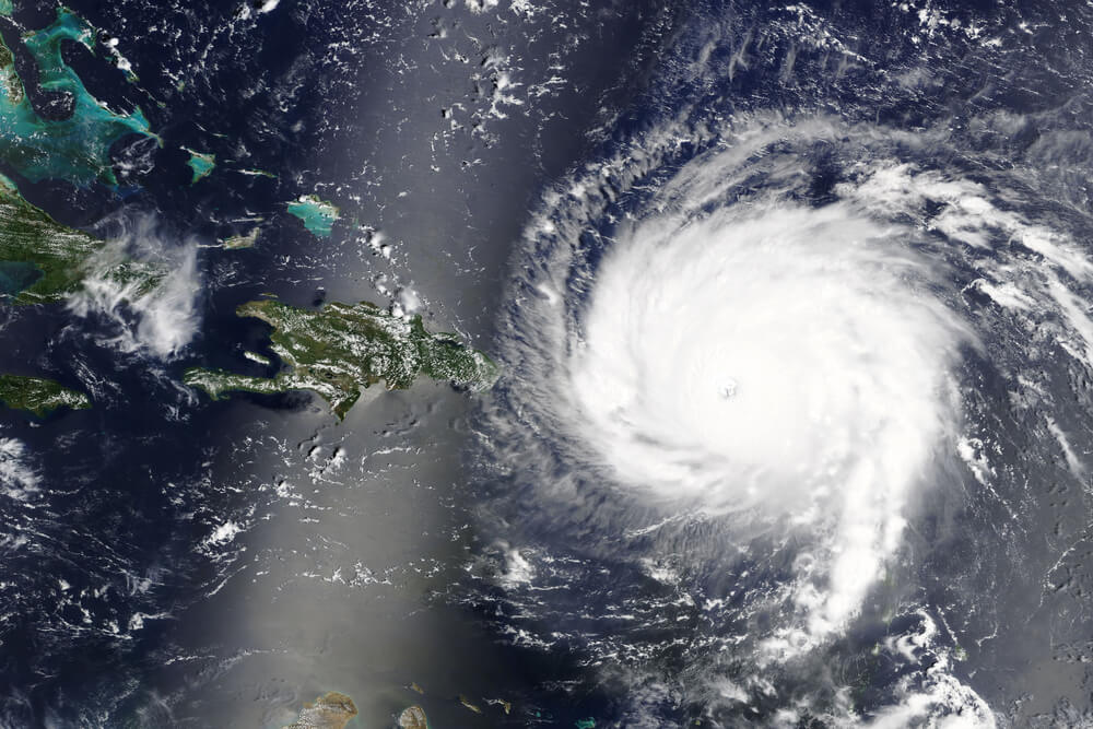
The changing climate – warmer average ocean temperatures, higher sea levels and changes in storm initiation and propagation – is already having a profound effect on many of the more than 5,000 U.S. military installations worldwide, including 1,700 that are located in coastal areas affected by sea level rise and storm patterns.
In 2018, Hurricane Michael caused $5 billion in damage to Florida’s Tyndall Air Force Base – including a dozen F-22 stealth fighter jets – while Hurricane Florence caused $3.6 billion in damages to North Carolina’s Marine Corps Base Camp Lejeune, according to official data compiled by the Environmental Defense Fund.
The following year, flooding along the Missouri River caused more than $500 million in damage at Offutt Air Force Base in Nebraska, and in 2021 winter storms damaged 694 facilities across Fort Hood in Texas, Fort Sill in Oklahoma, Fort Riley in Kansas, and Fort Polk in Louisiana.
The military branches are implementing a series of climate action plans to prepare for even more severe impacts. For example, the Navy’s plan warns that “if we do not act, as sea levels rise, bases like Norfolk Naval Base and Marine Corps Recruit Depot Parris Island will be severely tested in their ability to support their missions.”
Most recently, the Pentagon launched a Climate Resilience Portal to provide more detailed guidance “to consider climate change factors and impacts in all relevant and applicable decisions” and is making available a series of climate assessment tools. And in its fiscal 2024 budget request, the department sought $5.1 billion for “enhancing combat capability and mitigating climate risk.
Better predictive tools needed as climate hedge
But preparing the bases where the military trains and carries out its missions to this new reality is not a challenge that can be solved simply by throwing money at it.
To spend resources wisely, mitigation efforts can’t rely solely on data from historical events. They must also consider what conditions are likely to be in the future – in 20, 50, even 100 years. Nor can planning efforts assume every base or geographic area will be similarly affected. What is needed are rigorous, scientific and data-driven approaches that predict physical and operational impacts at specific facilities caused by climate change to inform the measures taken to alleviate them.
Our company, Binera, Inc., is currently demonstrating a novel risk management capability at Naval Air Station Patuxent River in Maryland. It shows how military facilities can make more informed decisions on selecting and designing mitigations to combat the increased risk of coastal surge inundation resulting from climate change.
The approach leverages the latest advancements in climate science, hydraulic modeling and risk assessment to assess potential future inundation risk. The process is based on the application of advanced weather models that can mimic tropical and extra-tropical cyclones that are in store for years to come.
Using this process, U.S. planners can simulate thousands of potential storms that could impact the naval station and surrounding communities, including potential future changes in storm frequency, intensity and propagation. They can also simulate the effects of sea level rise, waves and tides. The resulting inundation for each storm is evaluated using hydraulic modeling on a high-definition geographical mesh of the land, buildings and other features at the base and surrounding areas.
This approach produces extremely detailed flood maps that pinpoint specific vulnerable locations. Results are statistically evaluated across the set of synthetic storms to define flooding frequency in specific future years. One critical lesson from our work at Patuxent River is that while the flooding damage caused by extreme storms understandably gets much attention, there is a comparable level of risk posed by what we call “nuisance flooding.”
A decade ago, water on the runway might have been a yearly occurrence following a significant storm. But what if that became a weekly or even daily occurrence? With such frequency, what was otherwise considered a nuisance could conceivably destroy the base’s ability to operate effectively.
A comprehensive picture of future climate risk
As part of the implemented approach, we study the installation’s operational capabilities and vulnerabilities to assess how flooding at specific locations, predicted using the simulation tools, is likely to affect the Navy’s ability to fulfill its missions.
Taken together, the resulting data allows for a comprehensive assessment of future risk and forms the basis to measure the effectiveness of identified mitigation measures. The developed methodology can measure the risk reduction at the facility once countermeasures are deployed. Decisionmakers can then apply cost-benefit analysis to compare the potential of different solutions, identifying mitigation efforts that provide the biggest bang for the buck.
We see potential benefits in applying the approach beyond Patuxent River Naval Air Station to other military bases. The methodology can be used to inform a department-wide climate mitigation evaluation and prioritization process to ensure the investments will make the biggest difference in minimizing severe disruptions and safeguarding military readiness.
Without such a rigorous, data-driven approach, the Pentagon risks implementing costly countermeasures at its bases that are ineffective or only partially effective against future hazards, wasting enormous sums of money and time. Even worse, our most critical military bases could be adapting to the wrong threat.